Geolocate

Ranipet topographic map

Click on the map to display elevation.

About this map
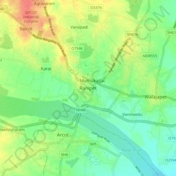
Name: Ranipet topographic map, elevation, terrain.

Location: Ranipet, Wallajah, Ranipet, Tamil Nadu, 632401, India (12.88925 79.29217 12.96925 79.37217)

Average elevation: 172 m

Minimum elevation: 151 m

Maximum elevation: 203 m

Other topographic maps

Click on a map to view its topography, its elevation and its terrain.

Wallajah

India > Tamil Nadu > Wallajah

Average elevation: 179 m

Gear up for your next adventure:

🔭Compact Monocular - One-handed bird watching and trail spotting
🧭Orienteering Kit - Tools for map reading and navigation in the wild
🕶️Polarized Sunglasses - Reduces glare from snow and water at high elevations
🥫Freeze-Dried Meals - Lightweight, high-calorie nutrition for multi-day treks
⛺Camping Groundsheet - Protect your tent from moisture and dirt

As an Amazon Associate, this site earns from qualifying purchases at no extra cost to you.