
Lake Seed topographic map
Click on the map to display elevation.
About this map
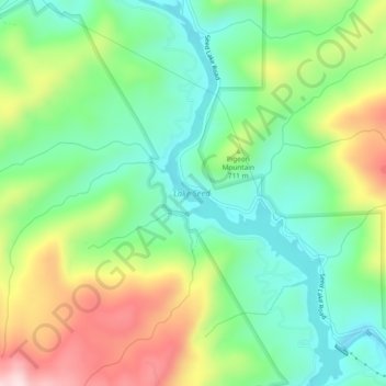
Name: Lake Seed topographic map, elevation, terrain.
Location: Lake Seed, Rabun County, Georgia, United States (34.75154 -83.52324 34.79016 -83.50066)
Average elevation: 653 m
Minimum elevation: 516 m
Maximum elevation: 896 m
Other topographic maps
Click on a map to view its topography, its elevation and its terrain.
Tallulah Gorge State Park
United States > Georgia > Rabun County > Tallulah Falls
Average elevation: 435 m
Black Rock Mountain State Park
United States > Georgia > Rabun County > Mountain City
Average elevation: 833 m