
Blalock topographic map
Click on the map to display elevation.
About this map
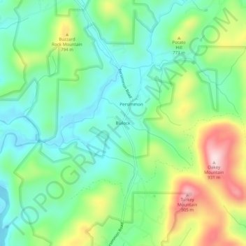
Name: Blalock topographic map, elevation, terrain.
Location: Blalock, Rabun County, Georgia, United States (34.87315 -83.53350 34.91315 -83.49350)
Average elevation: 682 m
Minimum elevation: 569 m
Maximum elevation: 914 m
Other topographic maps
Click on a map to view its topography, its elevation and its terrain.
Tallulah Gorge State Park
United States > Georgia > Rabun County > Tallulah Falls
Average elevation: 435 m
Black Rock Mountain State Park
United States > Georgia > Rabun County > Mountain City
Average elevation: 833 m