Geolocate

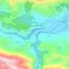
Cuñaba topographic map

Click on the map to display elevation.

About this map

Name: Cuñaba topographic map, elevation, terrain.

Location: Cuñaba, Peñamellera Baja, Asturias, España (43.26395 -4.70604 43.30182 -4.60662)

Average elevation: 576 m

Minimum elevation: 31 m

Maximum elevation: 1,551 m

Other topographic maps

Click on a map to view its topography, its elevation and its terrain.
Lles

España > Asturias > Peñamellera Baja

Average elevation: 249 m

Narganes

España > Asturias > Peñamellera Baja > Narganes

Average elevation: 174 m

Bores

España > Asturias > Peñamellera Baja > Bores

Average elevation: 343 m

Tobes

España > Asturias > Peñamellera Baja

Average elevation: 301 m

Panes

España > Asturias > Peñamellera Baja

Average elevation: 196 m

Bores

España > Asturias > Peñamellera Baja

Average elevation: 343 m

Gear up for your next adventure:

🧥Softshell Hiking Jacket - The perfect balance of wind protection and breathability
🧥Thermal Layer - Insulating layer for cold outdoor conditions
❄️Traction Ice Cleats - Slip-on spikes for icy trails and winter hiking
🥽Outdoor Goggles - Protective eyewear for outdoor activities
🧥Insulated Jacket - Keep warm in cold outdoor conditions

As an Amazon Associate, this site earns from qualifying purchases at no extra cost to you.