Geolocate

Panes topographic map

Click on the map to display elevation.

About this map

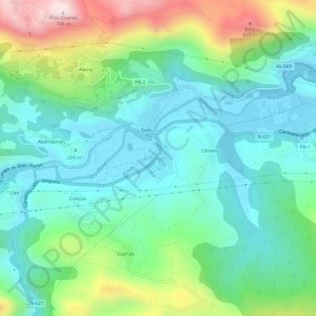
Name: Panes topographic map, elevation, terrain.

Location: Panes, Peñamellera Baja, Asturias, 33570, Spain (43.30342 -4.60399 43.34342 -4.56399)

Average elevation: 196 m

Minimum elevation: 10 m

Maximum elevation: 687 m

Gear up for your next adventure:

🔦LED Headlamp - Hands-free lighting for early morning starts or late finishes
🔭Compact Monocular - One-handed bird watching and trail spotting
Tent Footprint - Protect tent floor and increase durability
🧦Crew Hiking Socks - Comfortable socks for long-distance hikes
🧦Merino Wool Socks - Moisture-wicking comfort for long-distance hiking

As an Amazon Associate, this site earns from qualifying purchases at no extra cost to you.