
Sumner County topographic map
Interactive map
Click on the map to display elevation.
About this map
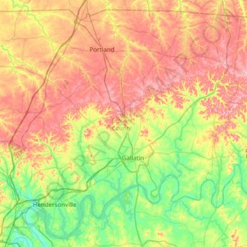
Name: Sumner County topographic map, elevation, terrain.
Location: Sumner County, Tennessee, United States (36.24420 -86.75480 36.65245 -86.20723)
Average elevation: 204 m
Minimum elevation: 118 m
Maximum elevation: 322 m
Other topographic maps
Click on a map to view its topography, its elevation and its terrain.
White House
United States > Tennessee > Sumner County > White House
White House, Sumner County, Middle Tennessee, Tennessee, 37188, United States
Average elevation: 254 m