Geolocate

Guanaba topographic map

Click on the map to display elevation.

About this map

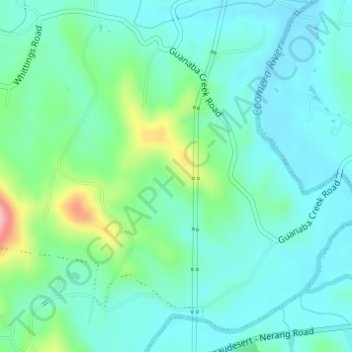
Name: Guanaba topographic map, elevation, terrain.

Location: Guanaba, Gold Coast, Queensland, Australia (-27.95996 153.24276 -27.93996 153.26276)

Average elevation: 51 m

Minimum elevation: 17 m

Maximum elevation: 169 m

Other topographic maps

Click on a map to view its topography, its elevation and its terrain.

Runaway Bay

Australia > Queensland > Gold Coast

Average elevation: 2 m

Reedy Creek

Australia > Queensland > Gold Coast

Average elevation: 16 m

Southport

Australia > Queensland > Gold Coast

Average elevation: 10 m

Mudgeeraba

Australia > Queensland > Gold Coast

Average elevation: 50 m

Kingsholme

Australia > Queensland > Gold Coast

Average elevation: 127 m

Gear up for your next adventure:

🔭Compact Monocular - One-handed bird watching and trail spotting
🥾Durable Hiking Shoes - Long-lasting shoes for frequent hiking
🕶️Polarized Sunglasses - Reduces glare from snow and water at high elevations
🧊Portable Cooler - Keep food and drinks cold during outdoor adventures
🌡️Emergency Mylar Blankets - Compact thermal protection for unexpected nights outdoors

As an Amazon Associate, this site earns from qualifying purchases at no extra cost to you.