Geolocate

Runaway Bay topographic map

Click on the map to display elevation.

About this map

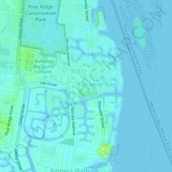
Name: Runaway Bay topographic map, elevation, terrain.

Location: Runaway Bay, Gold Coast, Queensland, Australia (-27.92738 153.38478 -27.89795 153.41504)

Average elevation: 2 m

Minimum elevation: -1 m

Maximum elevation: 16 m

Other topographic maps

Click on a map to view its topography, its elevation and its terrain.

Binna Burra

Australia > Queensland > Gold Coast

Average elevation: 535 m

Pimpama

Australia > Queensland > Gold Coast > Pimpama

Average elevation: 19 m

Reedy Creek

Australia > Queensland > Gold Coast

Average elevation: 16 m

Maudsland

Australia > Queensland > Gold Coast

Average elevation: 43 m

Lower Beechmont

Australia > Queensland > Gold Coast

Average elevation: 297 m

Clagiraba

Australia > Queensland > Gold Coast

Average elevation: 122 m

Guanaba

Australia > Queensland > Gold Coast

Average elevation: 51 m

Gear up for your next adventure:

💡Portable Camping Lamp - Rechargeable lamp for campsite lighting
🚲Bike Repair Kit - Essential tools for on-trail mechanical issues
Lightweight Camping Tent - Portable shelter optimized for Canadian backcountry camping
🧴Outdoor Sunscreen - High SPF protection for high-altitude UV exposure
💡Compact LED Flashlight - Powerful and portable flashlight for outdoor use

As an Amazon Associate, this site earns from qualifying purchases at no extra cost to you.