Geolocate

Columbia topographic map

Click on the map to display elevation.

About this map
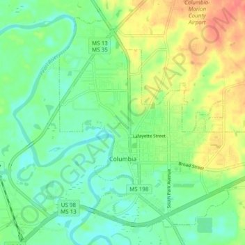
Name: Columbia topographic map, elevation, terrain.

Location: Columbia, Marion County, Mississippi, United States (31.23367 -89.85733 31.28926 -89.78137)

Average elevation: 52 m

Minimum elevation: 32 m

Maximum elevation: 85 m

Other topographic maps

Click on a map to view its topography, its elevation and its terrain.

Kokomo

United States > Mississippi > Marion County

Average elevation: 109 m

New Hope

United States > Mississippi > Marion County

Average elevation: 88 m

Sandy Hook

United States > Mississippi > Marion County

Average elevation: 45 m

Gear up for your next adventure:

🧶550 Survival Paracord - Versatile utility cord for emergency repairs and rigging
🥾Trekking Boots - Durable boots for long-distance trekking
☕Camping Coffee Maker - Brew fresh coffee anywhere on the topographic map
👟Sport Hiking Sandals - Breathable footwear for water crossings and camp rest
🧥Thermal Layer - Insulating layer for cold outdoor conditions

As an Amazon Associate, this site earns from qualifying purchases at no extra cost to you.