Geolocate

New Hope topographic map

Click on the map to display elevation.

About this map

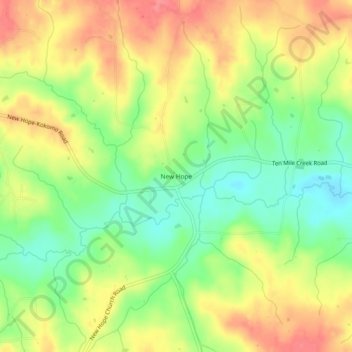
Name: New Hope topographic map, elevation, terrain.

Location: New Hope, Marion County, Mississippi, United States (31.13768 -89.93342 31.17768 -89.89342)

Average elevation: 88 m

Minimum elevation: 50 m

Maximum elevation: 124 m

Other topographic maps

Click on a map to view its topography, its elevation and its terrain.

Columbia

United States > Mississippi > Marion County

Average elevation: 52 m

Gear up for your next adventure:

🥾Trekking Boots - Durable boots for long-distance trekking
🧣Merino Neck Gaiter - Protects against wind, sun, and cold at high altitudes
🧭GPS Tracker - Track your location in remote areas safely
🥾Trail Running Boots - Durable shoes designed for trail running
🧰Survival Kit - Essential gear for emergencies in the wilderness

As an Amazon Associate, this site earns from qualifying purchases at no extra cost to you.