Geolocate

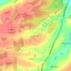
Little Harrowden topographic map

Click on the map to display elevation.

About this map

Name: Little Harrowden topographic map, elevation, terrain.

Location: Little Harrowden, North Northamptonshire, England, United Kingdom (52.32206 -0.78754 52.35121 -0.67997)

Average elevation: 81 m

Minimum elevation: 40 m

Maximum elevation: 120 m

Other topographic maps

Click on a map to view its topography, its elevation and its terrain.
Gear up for your next adventure:

🕶️Polarized Sunglasses - Protect your eyes with durable polarized lenses
🧢Sun Protection Cap - Breathable cap to protect from sun exposure
🧥Softshell Hiking Jacket - The perfect balance of wind protection and breathability
🧤Rechargeable Heated Gloves - Extreme warmth for Canadian winter expeditions
🧢Outdoor Cap - Protective cap for sun and rain during hikes

As an Amazon Associate, this site earns from qualifying purchases at no extra cost to you.