Geolocate

Wellingborough topographic map

Click on the map to display elevation.

About this map
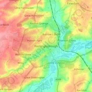
Name: Wellingborough topographic map, elevation, terrain.

Location: Wellingborough, North Northamptonshire, England, NN8 1AF, United Kingdom (52.26189 -0.73373 52.34189 -0.65373)

Average elevation: 76 m

Minimum elevation: 33 m

Maximum elevation: 120 m

Other topographic maps

Click on a map to view its topography, its elevation and its terrain.

Gear up for your next adventure:

⛺Camping Essentials - All-in-one gear for a comfortable camping trip
🥾Light Trekking Boots - Supportive boots for multi-day treks
🥾Mountain Hiking Boots - High-traction boots for rocky terrain
🧥Waterproof Hiking Jacket - Protect yourself from rain and wind while hiking
❄️Traction Ice Cleats - Slip-on spikes for icy trails and winter hiking

As an Amazon Associate, this site earns from qualifying purchases at no extra cost to you.