Geolocate

Laxton topographic map

Click on the map to display elevation.

About this map
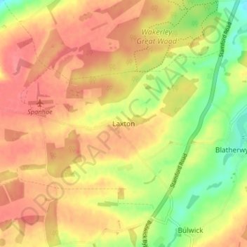
Name: Laxton topographic map, elevation, terrain.

Location: Laxton, North Northamptonshire, England, NN17 3AY, United Kingdom (52.53483 -0.61803 52.57483 -0.57803)

Average elevation: 86 m

Minimum elevation: 46 m

Maximum elevation: 112 m

Other topographic maps

Click on a map to view its topography, its elevation and its terrain.

Gear up for your next adventure:

🥾Hiking Shoes - Durable and comfortable shoes for trail hiking
🐕Hiking Dog Pack - Let your canine companion carry their own water and food
🧦Crew Hiking Socks - Comfortable socks for long-distance hikes
🥾Trail Hiking Boots - Supportive boots for rough trails
🚲Heavy Duty Bike Lock - Secure your bike at the trailhead or during stops

As an Amazon Associate, this site earns from qualifying purchases at no extra cost to you.