Geolocate

Condorcocha topographic map

Click on the map to display elevation.

About this map

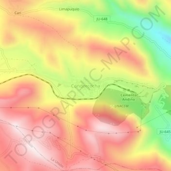
Name: Condorcocha topographic map, elevation, terrain.

Location: Condorcocha, La Unión, Province of Tarma, Junín, Peru (-11.39500 -75.81201 -11.35500 -75.77201)

Average elevation: 4,009 m

Minimum elevation: 3,602 m

Maximum elevation: 4,289 m

Gear up for your next adventure:

🧴First Aid Kit - Essential first aid supplies for outdoor emergencies
🎒Backpack Rain Cover - External shield to keep your entire pack dry
🪑Ultralight Camping Stool - Compact seating for rest stops during long hikes
🪑Insulated Seat Pad - Protect your seat from cold rocks and wet logs
🔦LED Flashlight - Powerful and long-lasting flashlight for camping and emergencies

As an Amazon Associate, this site earns from qualifying purchases at no extra cost to you.