Geolocate

Milan topographic maps

Click on a map to view its topography, its elevation and its terrain.
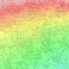
Milan

Italy > Lombardy > Milan > Milan

Average elevation: 130 m

Morimondo

Italy > Lombardy > Milan

Average elevation: 102 m

Quartiere Gallaratese

Italy > Lombardy > Milan > Milan

Average elevation: 137 m

Tregarezzo

Italy > Lombardy > Milan > Segrate > San Felice

Average elevation: 115 m

Sesto San Giovanni

Italy > Lombardy > Milan

Average elevation: 145 m

Trezzo sull'Adda

Italy > Lombardy > Milan

Average elevation: 188 m

Magenta

Italy > Lombardy > Milan

Average elevation: 132 m

Novate Milanese

Italy > Lombardy > Milan

Average elevation: 148 m

Legnano

Italy > Lombardy > Milan

Located in the south of the Varesine Prealps [it] along the Olona valley [it], the comune of Legnano has an area of 12.72 square kilometers (4.91 sq mi), has an elevation of 192–227 meters (630–745 ft) above sea level, and is seismically classified [it] in Zone 4 (Irrelevant seismology).

Average elevation: 210 m

Lacchiarella

Italy > Lombardy > Milan

Average elevation: 95 m

Cormano

Italy > Lombardy > Milan

Average elevation: 152 m

Cascina Confaloniera

Italy > Lombardy > Milan > Rosate

Average elevation: 107 m

Baranzate

Italy > Lombardy > Milan

Average elevation: 147 m

Vignate

Italy > Lombardy > Milan

Average elevation: 120 m

About this place

 •  •

Gear up for your next adventure:

🥾Waterproof Trail Shoes - Shoes designed to handle wet terrain
🧰Emergency Multi-Tool - Compact multi-tool for outdoor survival
🌬️Windproof Camp Stove - Efficient cooking even on exposed mountain peaks
☕Camping Coffee Maker - Brew fresh coffee anywhere on the topographic map
👟Sport Hiking Sandals - Breathable footwear for water crossings and camp rest

As an Amazon Associate, this site earns from qualifying purchases at no extra cost to you.