Geolocate

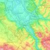
Bonn topographic maps

Click on a map to view its topography, its elevation and its terrain.

Bonn

Germany > North Rhine-Westphalia > Bonn

Average elevation: 138 m

Bonn-Beuel

Germany > North Rhine-Westphalia > Bonn

Average elevation: 75 m

Endenich

Germany > North Rhine-Westphalia > Bonn

Average elevation: 78 m

Holtorf

Germany > North Rhine-Westphalia > Bonn

Average elevation: 152 m

Bad Godesberg

Germany > North Rhine-Westphalia > Bonn

Average elevation: 118 m

Friesdorf

Germany > North Rhine-Westphalia > Bonn

Average elevation: 108 m

Gear up for your next adventure:

🏃Hydration Running Vest - Carry water and maps close to your body for speed
🥾Hiking Gaiters - Protect legs and shoes from mud, snow, and debris
🧥Waterproof Pants - Keep dry during rainy hiking conditions
🥾Trekking Poles - Adjustable trekking poles to reduce knee stress and improve stability
🥾Trail Hiking Socks - Comfortable socks to prevent blisters and fatigue

As an Amazon Associate, this site earns from qualifying purchases at no extra cost to you.