Geolocate

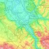
Bonn-Beuel topographic map

Click on the map to display elevation.

About this map

Name: Bonn-Beuel topographic map, elevation, terrain.

Location: Bonn-Beuel, Bonn, North Rhine-Westphalia, Germany (50.70337 7.07579 50.77441 7.20909)

Average elevation: 75 m

Minimum elevation: 43 m

Maximum elevation: 199 m

Other topographic maps

Click on a map to view its topography, its elevation and its terrain.
Bonn

Germany > North Rhine-Westphalia > Bonn

Average elevation: 138 m

Gear up for your next adventure:

⛺Family Camping Tent - Spacious tent suitable for family camping trips
🛁Quick-Dry Microfiber Towel - Space-saving towel that dries rapidly on the move
🧥Softshell Hiking Jacket - The perfect balance of wind protection and breathability
🛰️Satellite Messenger - Emergency communication for areas with no cell service
🧥Packable Rain Jacket - Breathable waterproof layer for unpredictable weather

As an Amazon Associate, this site earns from qualifying purchases at no extra cost to you.