Geolocate

Mamara topographic maps

Click on a map to view its topography, its elevation and its terrain.
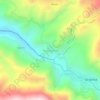
Huaruchaca

Peru > Apurímac > Mamara

Average elevation: 3,598 m

Gear up for your next adventure:

💧Hydration Bladder - Hands-free hydration solution for long treks
⛺Camping Tent - Weather-resistant tents suitable for 2 to 6 people
🔦LED Headtorch - Bright and durable light for night activities
🎒Hiking Daypack - Lightweight and durable backpacks for day trips and excursions
💧Filtered Water Bottle - Safe drinking water on the go

As an Amazon Associate, this site earns from qualifying purchases at no extra cost to you.