Click on a map to view its topography, its elevation and its terrain.
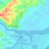
United Kingdom > England > Essex > Maldon > Burnham-on-Crouch
Average elevation: 7 m
United Kingdom > England > Essex > Maldon
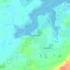
United Kingdom > England > Essex > Maldon > Burnham-on-Crouch > Stoneyhills
Average elevation: 17 m
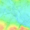
United Kingdom > England > Essex > Maldon > Langford
Average elevation: 14 m
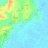
United Kingdom > England > Essex > Maldon > Latchingdon
Average elevation: 12 m
United Kingdom > England > Essex > Maldon > Dengie
Average elevation: 9 m
Average elevation: 46 m
United Kingdom > England > Essex > Maldon > Ulting
Average elevation: 25 m
United Kingdom > England > Essex > Maldon > Maldon
Average elevation: 20 m
United Kingdom > England > Essex > Maldon > Goldhanger
Average elevation: 8 m
As an Amazon Associate, this site earns from qualifying purchases at no extra cost to you.