Geolocate

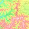
Monroe County topographic maps

Click on a map to view its topography, its elevation and its terrain.

Warrens

United States > Wisconsin > Monroe County

Average elevation: 309 m

Cashton

United States > Wisconsin > Monroe County

Average elevation: 406 m

Wilton

United States > Wisconsin > Monroe County

Average elevation: 321 m

Town of Byron

United States > Wisconsin > Monroe County

Average elevation: 280 m

Town of Wells

United States > Wisconsin > Monroe County

Average elevation: 332 m

Blyton Park

United States > Wisconsin > Monroe County > Sparta

Average elevation: 246 m

Tomah

United States > Wisconsin > Monroe County

Average elevation: 297 m

Town of Wilton

United States > Wisconsin > Monroe County

Average elevation: 379 m

Shennington

United States > Wisconsin > Monroe County

Average elevation: 278 m

Town of Sparta

United States > Wisconsin > Monroe County

Average elevation: 278 m

Kendall

United States > Wisconsin > Monroe County

Average elevation: 333 m

Town of Angelo

United States > Wisconsin > Monroe County

Average elevation: 262 m

Town of Leon

United States > Wisconsin > Monroe County

Average elevation: 295 m

Monroe County

United States > Wisconsin > Monroe County

Average elevation: 320 m

About this place

 •

Gear up for your next adventure:

🥾Waterproof Trail Shoes - Shoes designed to handle wet terrain
🥾Lightweight Hiking Shoes - Comfortable shoes for day hikes
🥾All-Terrain Hiking Boots - Versatile boots for varied hiking conditions
🛰️Satellite Messenger - Emergency communication for areas with no cell service
🌬️Windproof Camp Stove - Efficient cooking even on exposed mountain peaks

As an Amazon Associate, this site earns from qualifying purchases at no extra cost to you.