Geolocate

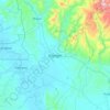
Bayugan topographic maps

Click on a map to view its topography, its elevation and its terrain.

Bayugan

Philippines > Agusan del Sur > Bayugan > Bayugan

Average elevation: 168 m

Gear up for your next adventure:

🐕Hiking Dog Pack - Let your canine companion carry their own water and food
⛺Camping Groundsheet - Protect your tent from moisture and dirt
⛺Tent Footprint - Protect tent floor and increase durability
🛶Waterproof Dry Bags - Keep electronics and clothes dry during river crossings
🕶️Polarized Sunglasses - Reduces glare from snow and water at high elevations

As an Amazon Associate, this site earns from qualifying purchases at no extra cost to you.