Geolocate

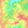
Pompignac topographic maps

Click on a map to view its topography, its elevation and its terrain.

Manial

France > Nouvelle-Aquitaine > Gironde > Pompignac

Average elevation: 69 m

Gear up for your next adventure:

🔥Camping Stove - Portable stoves to cook outdoors with ease
🔭Compact Monocular - One-handed bird watching and trail spotting
🚲Handlebar Phone Mount - View topographic-map.com live while cycling
🦟Insect Repellent - Keep mosquitoes and black flies away in wooded areas
🧦Hiking Socks - Moisture-wicking and comfortable socks for long hikes

As an Amazon Associate, this site earns from qualifying purchases at no extra cost to you.