

Nouvelle-Aquitaine topographic maps
Click on a map to view its topography, its elevation and its terrain.


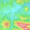


Ambernac
France > Nouvelle-Aquitaine > Charente
The relief of the commune is that of a plateau with an average altitude of 190 m; quite hilly as it is traversed from south to north by several valleys including that of the Charente to the west. The highest point of the commune is at an altitude of 232 m located in the Ambouriane Forest in the north-east. The…
Average elevation: 190 m


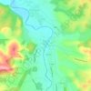



Bussière-Poitevine
France > Nouvelle-Aquitaine > Haute-Vienne > Val-d'Oire-et-Gartempe
Average elevation: 203 m


Creuse
It is in the Massif Central and permeated by the Creuse and its tributaries. The river is dammed at several locations both for water supply and hydroelectricity generation. As is typical for an inland area of continental Europe, Creuse has relatively cold winters with some snowfall into April, but also hot…
Average elevation: 503 m
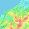


Vignols
France > Nouvelle-Aquitaine > Corrèze
The minimum altitude, 137 metres, is located in the extreme south-west, north of the place called the Moulin de Champagne, where a tributary of the Mayenne stream leaves the commune and enters that of Saint-Solve. The maximum altitude of 394 metres is located in the north, at a place called Le Caillou.
Average elevation: 276 m






Point de vue sur la tourbière des dauges
France > Nouvelle-Aquitaine > Haute-Vienne > Saint-Léger-la-Montagne > Marzet
Average elevation: 581 m

Urdazuri
France > Nouvelle-Aquitaine > Pyrénées-Atlantiques > Saint-Jean-de-Luz
Average elevation: 23 m



Saint-Seurin
France > Nouvelle-Aquitaine > Charente > Barbezieux-Saint-Hilaire
Average elevation: 78 m


