Geolocate

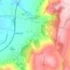
Stanway topographic maps

Click on a map to view its topography, its elevation and its terrain.

Stanway

United Kingdom > England > Gloucestershire > Tewkesbury > Stanway

Average elevation: 170 m

Gear up for your next adventure:

🗺️Topographic Maps - Detailed maps to explore trails, mountains, and wilderness areas
🧭GPS Outdoor Watch - Smart watch for navigation and fitness tracking in nature
💡LED Camping Lantern - Illuminate your campsite with long-lasting lanterns
🥾Trail Hiking Boots - Supportive boots for rough trails
🧦Thermal Socks - Warm socks for winter hiking or camping

As an Amazon Associate, this site earns from qualifying purchases at no extra cost to you.