Geolocate

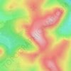
Lamplugh topographic maps

Click on a map to view its topography, its elevation and its terrain.

Blake Fell

United Kingdom > England > Cumberland > Lamplugh

Average elevation: 381 m

Gear up for your next adventure:

🧥Insulated Jacket - Keep warm in cold outdoor conditions
☕Camping Coffee Maker - Brew fresh coffee anywhere on the topographic map
🩹Moleskin Blister Pads - Direct protection for painful foot pressure points
🏃Hydration Running Vest - Carry water and maps close to your body for speed
🦶Hiking Shoe Insoles - Added support for high arches and long days on feet

As an Amazon Associate, this site earns from qualifying purchases at no extra cost to you.