Geolocate

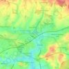
Upper Enham topographic maps

Click on a map to view its topography, its elevation and its terrain.

Andover

United Kingdom > England > Hampshire > Test Valley > Upper Enham

Average elevation: 88 m

Gear up for your next adventure:

🥾Hiking Shorts - Breathable shorts suitable for summer hikes
🧊Portable Cooler - Keep food and drinks cold during outdoor adventures
⛺Family Camping Tent - Spacious tent suitable for family camping trips
🔨Vehicle Emergency Tool - Safety tool for remote road trips to trailheads
🧭GPS Handheld Device - Reliable GPS navigation for outdoor adventures

As an Amazon Associate, this site earns from qualifying purchases at no extra cost to you.