Geolocate

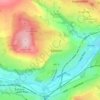
Baildon topographic maps

Click on a map to view its topography, its elevation and its terrain.

Baildon

United Kingdom > England > Bradford > Baildon > Baildon

Average elevation: 164 m

Gear up for your next adventure:

🚲Handlebar Phone Mount - View topographic-map.com live while cycling
🧭GPS Outdoor Watch - Smart watch for navigation and fitness tracking in nature
👟Sport Hiking Sandals - Breathable footwear for water crossings and camp rest
🧥Fleece Jacket - Warm and lightweight jacket for layering
🗺️Topographic Maps - Detailed maps to explore trails, mountains, and wilderness areas

As an Amazon Associate, this site earns from qualifying purchases at no extra cost to you.