Geolocate

Margate topographic maps

Click on a map to view its topography, its elevation and its terrain.

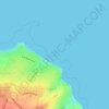
Botany Bay

United Kingdom > England > Kent > Thanet District > Margate

Average elevation: 9 m

Gear up for your next adventure:

🗺️Topographic Maps - Detailed maps to explore trails, mountains, and wilderness areas
🧴Bear Spray Holster - Quick-access carry for essential Canadian wilderness safety
💡LED Headlamp - Hands-free illumination for night hiking and camping
🦯Trekking Poles - Reduced impact on joints for steep topographic climbs
🧦Thermal Socks - Warm socks for winter hiking or camping

As an Amazon Associate, this site earns from qualifying purchases at no extra cost to you.