

Bavaria topographic maps
Click on a map to view its topography, its elevation and its terrain.
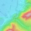
Neuschwanstein Castle
Germany > Bavaria > Landkreis Ostallgäu > Hohenschwangau
The municipality of Schwangau lies at an elevation of 800 m (2,620 ft) at the southwest border of the German state of Bavaria. Its surroundings are characterised by the transition between the Alpine foothills in the south (toward the nearby Austrian border) and a hilly landscape in the north that appears flat…
Average elevation: 982 m

Rain
The major cause of rain production is moisture moving along three-dimensional zones of temperature and moisture contrasts known as weather fronts. If enough moisture and upward motion is present, precipitation falls from convective clouds (those with strong upward vertical motion) such as cumulonimbus (thunder…
Average elevation: 414 m

Passau
On 2 June 2013, the old town suffered from severe flooding as a result of several days of rain and its location at the confluence of three rivers. Peak elevations of floods as early as 1501 are displayed on a wall at the Old City Hall. Flood water reaches the base of that wall on average once every 5 years.
Average elevation: 401 m

Lenggries
Germany > Bavaria > Landkreis Bad Tölz-Wolfratshausen
Lenggries sits on the Isar River before it transitions into the Alpine foothills. To the east are the Tegernsee Mountains, to the west lies the home mountain of Lenggries known as the Brauneck with an elevation of over 1,555 meters above sea level. The Brauneck is a well known ski area tied together by lifts.…
Average elevation: 1,096 m


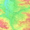
Nuremberg
Nuremberg has an oceanic climate (Köppen Cfb) with a certain humid continental influence (Dfb), categorized in the latter by the 0 °C isotherm. The city's climate is influenced by its inland position and higher altitude. Winters are changeable, with either mild or cold weather: the average temperature is…
Average elevation: 336 m







Ziegelhütte
Germany > Bavaria > Landkreis Wunsiedel im Fichtelgebirge > Marktredwitz
Average elevation: 563 m


