Geolocate

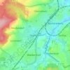
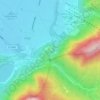
Straubing topographic map

Click on the map to display elevation.

About this map

Name: Straubing topographic map, elevation, terrain.

Location: Straubing, Bavaria, 94315, Germany (48.84171 12.48022 48.92463 12.66709)

Average elevation: 330 m

Minimum elevation: 312 m

Maximum elevation: 401 m

Other topographic maps

Click on a map to view its topography, its elevation and its terrain.
Neuschwanstein Castle

Germany > Bavaria > Landkreis Ostallgäu > Hohenschwangau

The municipality of Schwangau lies at an elevation of 800 m (2,620 ft) at the southwest border of the German state of Bavaria. Its surroundings are characterised by the transition between the Alpine foothills in the south (toward the nearby Austrian border) and a hilly landscape in the north that appears flat…

Average elevation: 982 m

Nebelhorn

Germany > Bavaria > Landkreis Oberallgäu

Average elevation: 1,792 m

Edenberg

Germany > Bavaria > Landkreis Rosenheim > Griesstätt

Average elevation: 457 m

Niederachen

Germany > Bavaria > Landkreis Traunstein > Inzell

Average elevation: 768 m

Wind

Germany > Bavaria > Landkreis Bamberg

Average elevation: 284 m

Am See

Germany > Bavaria > Landkreis Miesbach > Sankt Quirin

Average elevation: 797 m

Voyager

Germany > Bavaria > Landkreis Forchheim > Großenohe

Average elevation: 475 m

Lobach

Germany > Bavaria > Landkreis Ostallgäu > Lobach

Average elevation: 817 m

Gear up for your next adventure:

🐕Hiking Dog Pack - Let your canine companion carry their own water and food
🛌Insulated Sleeping Pad - Critical thermal barrier between you and the cold ground
💡Compact LED Flashlight - Powerful and portable flashlight for outdoor use
🥾Trail Hiking Socks - Comfortable socks to prevent blisters and fatigue
🕯️Camping Lantern - Illuminates your entire campsite with high-efficiency LEDs

As an Amazon Associate, this site earns from qualifying purchases at no extra cost to you.