

Quebec topographic maps
Click on a map to view its topography, its elevation and its terrain.

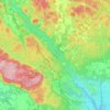

Parc régional du Poisson-Blanc
Canada > Quebec > Antoine-Labelle > Notre-Dame-du-Laus
Average elevation: 238 m


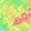

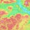

Lake Saint-Louis
Canada > Quebec > Urban agglomeration of Montreal > Sainte-Anne-de-Bellevue
Average elevation: 34 m


About this place
Les Collines-de-l'Outaouais • Antoine-Labelle • La Vallée-du-Richelieu • La Nouvelle-Beauce • Lotbinière (MRC) • Les Laurentides • Rouyn-Noranda • Les Pays-d'en-Haut • Témiscouata • Les Chenaux • Lac-Saint-Jean-Est • Sept-Rivières • Memphrémagog • Deux-Montagnes • Abitibi • Urban agglomeration of Montreal • Huntingdon • Brome-Missisquoi • Les Basques