Geolocate

Frampton topographic map

Click on the map to display elevation.

About this map

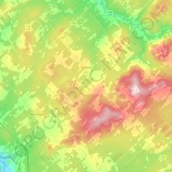
Name: Frampton topographic map, elevation, terrain.

Location: Frampton, La Nouvelle-Beauce, Chaudière-Appalaches, Quebec, G0R 1M0, Canada (46.36215 -70.89794 46.52835 -70.68879)

Average elevation: 373 m

Minimum elevation: 141 m

Maximum elevation: 657 m

La Nouvelle-Beauce trails, hiking, mountain biking, running and outdoor activities

Gear up for your next adventure:

💧Collapsible Water Bottle - Space-saving water bottle for outdoor activities
🥾Trail Hiking Boots - Supportive boots for rough trails
🛏️Sleeping Bag - Warm and compact sleeping bags for outdoor camping
🛌Insulated Sleeping Pad - Critical thermal barrier between you and the cold ground
🎒Hiking Daypack - Lightweight and durable backpacks for day trips and excursions

As an Amazon Associate, this site earns from qualifying purchases at no extra cost to you.