Geolocate

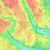
Tatling End topographic maps

Click on a map to view its topography, its elevation and its terrain.

Gear up for your next adventure:

🗺️Topographic Maps - Detailed maps to explore trails, mountains, and wilderness areas
🛰️Satellite Messenger - Emergency communication for areas with no cell service
🐕Hiking Dog Pack - Let your canine companion carry their own water and food
💡LED Headlamp - Hands-free illumination for night hiking and camping
🔋Emergency Crank Radio - Weather alerts and power without needing batteries

As an Amazon Associate, this site earns from qualifying purchases at no extra cost to you.