Geolocate

Improvement District No. 24 topographic maps

Click on a map to view its topography, its elevation and its terrain.

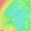
Lake Claire

Canada > Alberta > Improvement District No. 24

The lake has a total area of 1,436 km2 (554 sq mi), with 21 km2 (8.1 sq mi) island area, and lies at an elevation of 213 m (699 ft). It is the largest lake located entirely within Albertan boundaries. Lake Athabasca, which straddles the border with Saskatchewan, is larger.

Average elevation: 214 m

Gear up for your next adventure:

🚑Survival Whistle - Signal for help across long distances in mountains
🧭Orienteering Kit - Tools for map reading and navigation in the wild
🧣Merino Neck Gaiter - Protects against wind, sun, and cold at high altitudes
🛰️Satellite Messenger - Emergency communication for areas with no cell service
🚲Handlebar Phone Mount - View topographic-map.com live while cycling

As an Amazon Associate, this site earns from qualifying purchases at no extra cost to you.