Geolocate

Stratton topographic maps

Click on a map to view its topography, its elevation and its terrain.
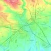
Cirencester

United Kingdom > England > Gloucestershire > Cotswold District > Stratton

On Cotswold Avenue is the site of a Roman amphitheatre which, while buried, retains its shape in the earthen topography of the small park setting. Cirencester was one of the most substantial cities of Roman-era Britain.

Average elevation: 128 m

Gear up for your next adventure:

🛏️Camping Sleeping Mat - Comfortable mats for sleeping outdoors
🚲Handlebar Phone Mount - View topographic-map.com live while cycling
🏃Hydration Running Vest - Carry water and maps close to your body for speed
🧢Beanie Hat - Keep your head warm in cold weather
🧴First Aid Kit - Essential first aid supplies for outdoor emergencies

As an Amazon Associate, this site earns from qualifying purchases at no extra cost to you.