Geolocate

Labette County topographic maps

Click on a map to view its topography, its elevation and its terrain.

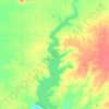
Big Hill Lake

United States > Kansas > Labette County

Average elevation: 279 m

Gear up for your next adventure:

🚲MTB Frame Bag - Carry tools and maps directly on your bicycle frame
🥾Waterproof Hiking Boots - Boots keeping your feet dry in wet conditions
☕Camping Coffee Maker - Brew fresh coffee anywhere on the topographic map
🌡️Emergency Mylar Blankets - Compact thermal protection for unexpected nights outdoors
⛺Tent Footprint - Protect tent floor and increase durability

As an Amazon Associate, this site earns from qualifying purchases at no extra cost to you.