Geolocate

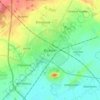
Bicester topographic maps

Click on a map to view its topography, its elevation and its terrain.

Bicester

United Kingdom > England > Bicester

Average elevation: 79 m

Gear up for your next adventure:

🛶Canoe Life Vest - Safety vest for water sports
🧭Orienteering Kit - Tools for map reading and navigation in the wild
🚑Survival Whistle - Signal for help across long distances in mountains
🥾Approach Shoes - Shoes designed for climbing approaches and rugged trails
🚲MTB Frame Bag - Carry tools and maps directly on your bicycle frame

As an Amazon Associate, this site earns from qualifying purchases at no extra cost to you.