Geolocate

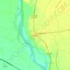
Baghpat topographic maps

Click on a map to view its topography, its elevation and its terrain.

Baghpat

India > Uttar Pradesh > Baghpat

Average elevation: 219 m

Gear up for your next adventure:

🧢Outdoor Visor - Breathable visor for sunny hikes
🛶Waterproof Dry Bags - Keep electronics and clothes dry during river crossings
🦯Trekking Poles - Reduced impact on joints for steep topographic climbs
🧭GPS Outdoor Watch - Smart watch for navigation and fitness tracking in nature
🧢Sun Protection Cap - Breathable cap to protect from sun exposure

As an Amazon Associate, this site earns from qualifying purchases at no extra cost to you.