

Bechar topographic maps
Click on a map to view its topography, its elevation and its terrain.

Boukais
Algeria > Bechar > Lahmar District
Boukaïs lies at an elevation of 851 metres (2,792 ft) on a rocky plain at the edge of a region of higher, darkly colored rocky hills. There is an even higher range of lightly colored hills to the west. The Oued Ihrassa passes by the town to the east; water from this river is used to irrigate the palm grove…
Average elevation: 912 m

Erg Ferradj
Algeria > Bechar > Abadla District
Erg Ferradj lies at an elevation of 589 metres (1,932 ft) to the west of an extensive palm plantation covering 3000 hectares lying along the western side of the Oued Guir. The rocky hills of the hamada are found on both sides of the river, but are more dramatic on the eastern side.
Average elevation: 678 m
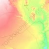
Mechraa Houari Boumediene
Algeria > Bechar > Abadla District
Méchraâ Houari Boumédienne lies at an elevation of 572m to the west of the Oued Guir, an intermittent wadi, and just south of the town of Abadla. From here through Abadla to Erg Ferradj is the site of an extensive 3000 hectare palm plantation.
Average elevation: 632 m

Meridja
Algeria > Bechar > Kénadsa District
Méridja is located at an elevation of 782 metres (2,566 ft) on the extensive hamada west of Béchar, about 15 kilometres (9.3 mi) west of the Djorf Torba dam on the Oued Guir. Some low, rocky hills rise both to the north and south of the town, but there are no significant mountains in the immediate vicinity…
Average elevation: 810 m
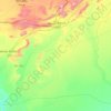
Beni Ounif
Algeria > Bechar > Béni Ounif
Béni Ounif lies at an elevation of 829 metres (2,720 ft) on the Oued Zouzfana downstream of Figuig. To the south the landscape is mostly flat, with a few small hills, while to the north there is a range of taller, rocky hills running from west to east along the Algeria–Morocco border. Aside from the river…
Average elevation: 825 m
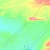
Lahmar
Algeria > Bechar > Lahmar District
Lahmar lies at an altitude of 939 metres (3,081 ft) on a rocky plain with scattered higher mountains to the east. One prominent range of hills is just to the east, and separates Lahmar from the nearby locality of Sfissifa.
Average elevation: 905 m

Mougheul
Algeria > Bechar > Lahmar District
Mogheul lies at an elevation of 1,026 metres (3,366 ft) on a plateau crossed by ranges of rocky hills. Small ranges rising about 100 metres (330 ft) above the surrounds are found quite nearby the town to the north and south; higher ranges are found further to the northeast and further south.
Average elevation: 1,067 m

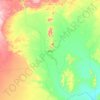
Bechar
Algeria > Bechar > Da'ira Bechar
Béchar lies at an elevation of 747 metres (2,451 ft) on the banks of Oued Béchar, which runs through the city from northeast to southwest. The rocky highlands of the Djebel Béchar overlook the city from the southeast, reaching 1,206 metres (3,957 ft) to the east of the city. Further to the northeast the…
Average elevation: 810 m

Kenadsa
Algeria > Bechar > Kénadsa District
Kénadsa lies at an elevation of 784 metres (2,572 ft) on the flat rocky hamada west of Béchar. The wadi Oued Meswar is located about 6 kilometres (3.7 mi) west of the town, and meets the Oued Guir near Abadla at the locality of Ksi Ksou.
Average elevation: 747 m