

Gogebic County topographic maps
Click on a map to view its topography, its elevation and its terrain.
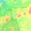
Ironwood
United States > Michigan > Gogebic County
In the early 1960s, the U.S. Air Force established a Strategic Air Command (SAC) Radar Bomb Scoring site atop Norrie hill to track and score high altitude and treetop level simulated bomb runs by B-52s and B-47s on targets in the Ironwood area. A monument is erected south of Hurley, Wisconsin to remember those…
Average elevation: 458 m