Geolocate

Thuringia topographic maps

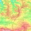
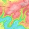
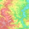
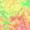
Click on a map to view its topography, its elevation and its terrain.

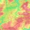
Jena

Germany > Thuringia

Jena is situated in a hilly landscape in eastern Thuringia at the Saale river, between the Harz mountains 85 km (53 mi) in the north, the Thuringian Forest/Thuringian Highland 50 km (31 mi) in the southwest and the Ore Mountains, 75 km (47 mi) in the southeast. The municipal terrain is hilly with rugged slopes…

Average elevation: 283 m

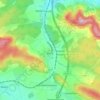
Rudersdorf

Germany > Thuringia > Landkreis Sömmerda

Average elevation: 206 m

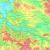
Hermsdorf

Germany > Thuringia > Saale-Holzland-Kreis

Average elevation: 339 m

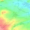
Eisenach

Germany > Thuringia > Wartburgkreis

Eisenach is situated at the northern edge of the Thuringian Forest, at an elevation of about 220 m. The terrain is hilly, to the south also mountainous (up to 460 m of elevation), with the central Hörsel valley crossing the town in east-western direction. The Nesse river enters the Hörsel river in Eisenach…

Average elevation: 298 m
Tanna

Germany > Thuringia > Saale-Orla-Kreis

Average elevation: 539 m

Sonneberg

Germany > Thuringia > Landkreis Sonneberg

"The Sonneberg Castle was also called Sonneberg Castle or the Haus zu Sonneberg in old documents. In 480 Süne or Süno, Duke of Franconia, built this castle because of the Thuringian incursions ..." so it says on page 64 in the topography of the Duke of Saxe-Meiningen's share in the Duchy of Coburg from the…

Average elevation: 586 m
Schleiz

Germany > Thuringia > Saale-Orla-Kreis

Average elevation: 480 m

Wilhelmsdorf

Germany > Thuringia > Saale-Orla-Kreis

Average elevation: 425 m

Bad Lobenstein

Germany > Thuringia > Saale-Orla-Kreis

Average elevation: 560 m

Triptis

Germany > Thuringia > Saale-Orla-Kreis

Average elevation: 367 m

Lederhose

Germany > Thuringia > Greiz

Average elevation: 363 m

Silkerode

Germany > Thuringia > Landkreis Eichsfeld > Sonnenstein

Average elevation: 256 m

Erfurt

Germany > Thuringia

Erfurt is situated in the south of the Thuringian basin, a fertile agricultural area between the Harz mountains 80 km (50 mi) to the north and the Thuringian forest 30 km (19 mi) to the southwest. Whereas the northern parts of the city area are flat, the southern ones consist of hilly landscape up to 430 m of…

Average elevation: 251 m

About this place

 •  •  •  •  •  •  •

Gear up for your next adventure:

🧊Insulated Water Bottle - Keeps drinks cold in summer and prevents freezing in winter
🥾Mountain Hiking Boots - High-traction boots for rocky terrain
🔋Emergency Crank Radio - Weather alerts and power without needing batteries
🥫Freeze-Dried Meals - Lightweight, high-calorie nutrition for multi-day treks
🐕Hiking Dog Pack - Let your canine companion carry their own water and food

As an Amazon Associate, this site earns from qualifying purchases at no extra cost to you.