Geolocate

Triptis topographic map

Click on the map to display elevation.

About this map

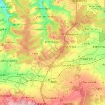
Name: Triptis topographic map, elevation, terrain.

Location: Triptis, Saale-Orla-Kreis, Thuringia, 07819, Germany (50.72053 11.76264 50.79935 11.90403)

Average elevation: 367 m

Minimum elevation: 258 m

Maximum elevation: 472 m

Gear up for your next adventure:

🧊Insulated Water Bottle - Keeps drinks cold in summer and prevents freezing in winter
🔭Outdoor Binoculars - Lightweight binoculars for birdwatching and hiking
🧭GPS Tracker - Track your location in remote areas safely
🕶️Polarized Sunglasses - Protect your eyes with durable polarized lenses
🚲MTB Frame Bag - Carry tools and maps directly on your bicycle frame

As an Amazon Associate, this site earns from qualifying purchases at no extra cost to you.