

Union County topographic maps
Click on a map to view its topography, its elevation and its terrain.


Alto Pass
United States > Illinois > Union County
The settlement developed as a railroad and agricultural shipping point. According to the Sundown Towns Database, Alto Pass was named because it was the highest elevation in Illinois traversed by a railroad, and by the turn of the 20th century the village had a post office, general stores, hotels, a blacksmith…
Average elevation: 214 m


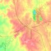
Anna
United States > Illinois > Union County
The coming of the railroad can be credited for prompting the founding of the City of Anna, although, from the time of the George Rogers Clark expedition into Southern Illinois country, emigrants recognized its agricultural possibilities. Centrally located in Anna Precinct of Union County, Anna was established…
Average elevation: 183 m