Geolocate

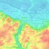
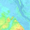
Stade topographic maps

Click on a map to view its topography, its elevation and its terrain.

Großenwörden

Germany > Lower Saxony > Stade

Average elevation: 1 m

Hamelwörden

Germany > Lower Saxony > Stade

Average elevation: 0 m

Drochtersen

Germany > Lower Saxony > Stade

Average elevation: 0 m

Bliedersdorf

Germany > Lower Saxony > Stade

Average elevation: 25 m

Buxtehude

Germany > Lower Saxony > Stade

Average elevation: 21 m

Krummendeich

Germany > Lower Saxony > Stade

Average elevation: 0 m

Hörne

Germany > Lower Saxony > Stade

Average elevation: 0 m

Börne

Germany > Lower Saxony > Stade > Stade

Average elevation: 5 m

Stade

Germany > Lower Saxony > Stade

Average elevation: 4 m

About this place

Gear up for your next adventure:

💡Portable Camping Lamp - Rechargeable lamp for campsite lighting
🛌Insulated Sleeping Pad - Critical thermal barrier between you and the cold ground
👟Sport Hiking Sandals - Breathable footwear for water crossings and camp rest
🦶Anti-Blister Balm - Prevents friction and hotspots during long ascents
🌡️Emergency Mylar Blankets - Compact thermal protection for unexpected nights outdoors

As an Amazon Associate, this site earns from qualifying purchases at no extra cost to you.