
LaBelle topographic map
Interactive map
Click on the map to display elevation.
About this map
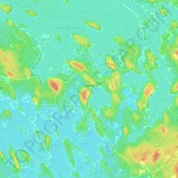
Name: LaBelle topographic map, elevation, terrain.
Average elevation: 81 m
Minimum elevation: 66 m
Maximum elevation: 131 m
Queens County trails, hiking, mountain biking, running and outdoor activities
Other topographic maps
Click on a map to view its topography, its elevation and its terrain.
Mersey River
Canada > Nova Scotia > Queens County > Kejimkujik National Park of Canada
Average elevation: 93 m
Cape Split
Canada > Nova Scotia > Queens County > Kejimkujik National Park of Canada
Average elevation: 130 m