
Province of Maynas topographic map
Interactive map
Click on the map to display elevation.
About this map
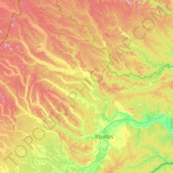
Name: Province of Maynas topographic map, elevation, terrain.
Location: Province of Maynas, Loreto, Peru (-4.70971 -75.78115 -0.63885 -72.11719)
Average elevation: 140 m
Minimum elevation: 70 m
Maximum elevation: 336 m
Other topographic maps
Click on a map to view its topography, its elevation and its terrain.
Santa Fe
Peru > Loreto > Emilio San Martín
Santa Fe, Emilio San Martín, Province of Requena, Loreto, Peru
Average elevation: 103 m
Province of Maynas
Province of Maynas, Mazán, Maynas, Loreto, Peru
Average elevation: 107 m