
Upper Nile topographic map
Interactive map
Click on the map to display elevation.
About this map
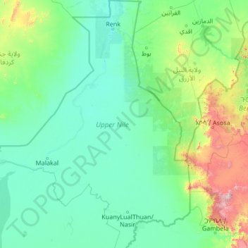
Name: Upper Nile topographic map, elevation, terrain.
Location: Upper Nile, South Sudan (7.98787 30.75617 12.23639 34.14552)
Average elevation: 562 m
Minimum elevation: 380 m
Maximum elevation: 2,973 m
Other topographic maps
Click on a map to view its topography, its elevation and its terrain.