

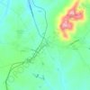
Rustburg topographic map
Click on the map to display elevation.
Rustburg
Rustburg is located in north-central Campbell County at 37°16′25″N 79°05′56″W / 37.273731°N 79.098914°W / 37.273731; -79.098914 (37.273731, −79.098914). U.S. Route 501 passes through the center of town, leading north 11 miles (18 km) to Lynchburg and south 20 miles (32 km) to Brookneal. Virginia Route 24 also leads through the center of town, running northeast 9 miles (14 km) to Concord and west 5 miles (8 km) to U.S. Route 29 at Yellow Branch. Long Mountain, topped with communication towers, rises to a summit elevation of 1,440 feet (440 m) northeast of the center of town.
About this map

Name: Rustburg topographic map, elevation, terrain.
Location: Rustburg, Campbell County, Virginia, 24588, United States (37.23171 -79.13439 37.31968 -79.06323)
Average elevation: 262 m
Minimum elevation: 193 m
Maximum elevation: 429 m
Other topographic maps
Click on a map to view its topography, its elevation and its terrain.

Rustburg
United States > Virginia > Campbell County
Rustburg is located in north-central Campbell County at 37°16′25″N 79°05′56″W / 37.273731°N 79.098914°W / 37.273731; -79.098914 (37.273731, −79.098914). U.S. Route 501 passes through the center of town, leading north 11 miles (18 km) to Lynchburg and south 20 miles (32 km) to Brookneal.…
Average elevation: 272 m