
Concord topographic map
Click on the map to display elevation.
About this map
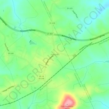
Name: Concord topographic map, elevation, terrain.
Location: Concord, Campbell County, Virginia, 24538, United States (37.32264 -78.99502 37.36264 -78.95502)
Average elevation: 253 m
Minimum elevation: 210 m
Maximum elevation: 339 m
Other topographic maps
Click on a map to view its topography, its elevation and its terrain.
Rustburg
United States > Virginia > Campbell County
Rustburg is located in north-central Campbell County at 37°16′25″N 79°05′56″W / 37.273731°N 79.098914°W / 37.273731; -79.098914 (37.273731, −79.098914). U.S. Route 501 passes through the center of town, leading north 11 miles (18 km) to Lynchburg and south 20 miles (32 km) to Brookneal.…
Average elevation: 262 m