
Thank you for supporting this site ❤️
Make a donation
Make a donation
Gear up for your next adventure:
As an Amazon Associate, this site earns from qualifying purchases at no extra cost to you.
Jungholz topographic map
Click on the map to display elevation.
Thank you for supporting this site ❤️
Make a donation
Make a donation
Gear up for your next adventure:
As an Amazon Associate, this site earns from qualifying purchases at no extra cost to you.
About this map
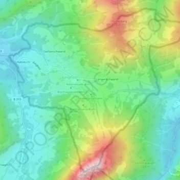
Name: Jungholz topographic map, elevation, terrain.
Location: Jungholz, Bezirk Reutte, Tyrol, 6691, Austria (47.55466 10.42900 47.58713 10.48201)
Average elevation: 1,139 m
Minimum elevation: 909 m
Maximum elevation: 1,585 m
Thank you for supporting this site ❤️
Make a donation
Make a donation
Gear up for your next adventure:
As an Amazon Associate, this site earns from qualifying purchases at no extra cost to you.